Highway & Road
There are many construction project has the design has been completed available by the Professional
At Aruljothi Digital Surveyors, we specialize in providing detailed and accurate highway road survey services to ensure the successful planning, design, and construction of your highway projects. Our team of experienced surveyors utilizes state-of-the-art technology and methodologies to deliver high-quality results tailored to your specific needs.

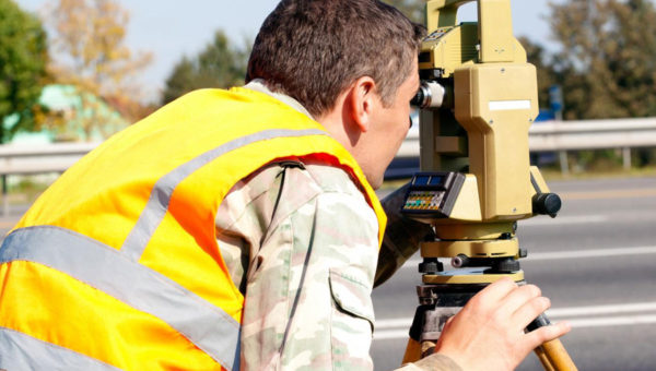
Engineering Support
Many construction projects require comprehensive engineering support to ensure successful completion and adherence to standards.
At Aruljothi Digital Surveyors, we provide specialized engineering support services to meet the unique needs of your project. Our experienced team offers a range of expertise to support various aspects of construction projects, including planning, design, quality control, and more.

Aerial Data Collection
Aerial data collection is crucial for obtaining accurate information for various projects and industries.
Aruljothi Digital Surveyors specializes in aerial data collection using cutting-edge drone technology. We provide high-resolution aerial imagery, topographic mapping, 3D modeling, and more to support a wide range of applications including land surveying, construction site monitoring, environmental assessment, and agriculture.

Laser Scanning
Laser scanning technology provides precise and detailed 3D data for various applications.
Aruljothi Digital Surveyors offers advanced laser scanning services to capture accurate spatial data of objects, buildings, and landscapes. Our laser scanning solutions are used in construction, architecture, heritage preservation, industrial facilities, and more. We provide highly detailed point clouds and 3D models for better project visualization, analysis, and planning.

GIS & Mapping
GIS and mapping services play a crucial role in analyzing and visualizing spatial data for informed decision-making.
Aruljothi Digital Surveyors provides comprehensive GIS and mapping solutions tailored to your needs. We offer spatial data analysis, map creation, asset management, spatial modeling, and more. Our services help organizations across various sectors including urban planning, natural resource management, infrastructure development, and environmental assessment.

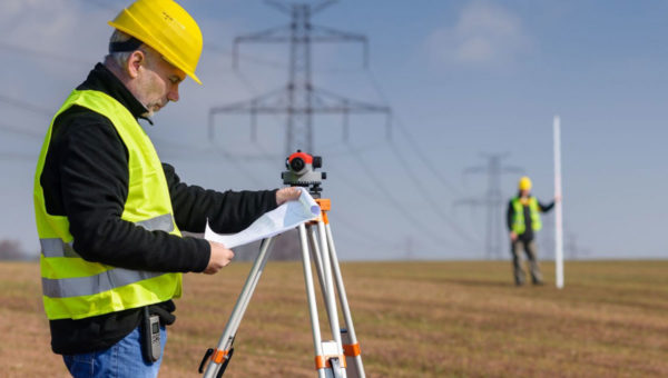
Flyover & Railway Survey
Flyover and railway surveys are essential for infrastructure development and maintenance.
Aruljothi Digital Surveyors offers specialized surveying services for flyover and railway projects. We provide accurate data collection, alignment surveys, track monitoring, clearance analysis, and more to support the planning, design, and maintenance of transportation infrastructure. Our surveys ensure safety, efficiency, and compliance with standards.
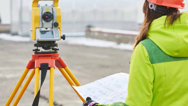
Cadastral & Land Plan
Cadastral and land planning services are essential for property management and development.
Aruljothi Digital Surveyors offers cadastral and land planning services to help property owners, developers, and government agencies manage land parcels effectively. We provide cadastral surveys, boundary demarcation, land subdivision planning, and land use planning services. Our expertise ensures accurate land documentation and compliance with legal requirements.
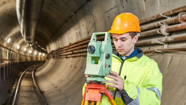
Tunnel Survey
Tunnel surveys are crucial for the planning, design, and construction of tunnels and underground structures.
Aruljothi Digital Surveyors provides comprehensive tunnel surveying services to support tunneling projects. Our experienced team utilizes advanced surveying techniques and equipment to ensure accurate data collection inside tunnels. We offer tunnel alignment surveys, deformation monitoring, cross-sectional surveys, and as-built surveys. Our surveys help ensure the safety, stability, and quality of tunnel projects.
3D City Mapping
3D city mapping provides detailed spatial information for urban planning, development, and visualization.
Aruljothi Digital Surveyors offers advanced 3D city mapping services using cutting-edge technology. We create highly accurate and detailed 3D models of cities and urban areas, including buildings, streets, landmarks, and terrain. Our 3D city models are used for urban planning, infrastructure development, disaster management, tourism promotion, and more. We provide valuable insights for decision-making and visualization of city environments.
Highway & Road
There are many construction project has the design has been completed available by the Professional
At Aruljothi Digital Surveyors, we specialize in providing detailed and accurate highway road survey services to ensure the successful planning, design, and construction of your highway projects. Our team of experienced surveyors utilizes state-of-the-art technology and methodologies to deliver high-quality results tailored to your specific needs.
Engineering Support
Many construction projects require comprehensive engineering support to ensure successful completion and adherence to standards.
At Aruljothi Digital Surveyors, we provide specialized engineering support services to meet the unique needs of your project. Our experienced team offers a range of expertise to support various aspects of construction projects, including planning, design, quality control, and more.
Aerial Data Collection
Aerial data collection is crucial for obtaining accurate information for various projects and industries.
Aruljothi Digital Surveyors specializes in aerial data collection using cutting-edge drone technology. We provide high-resolution aerial imagery, topographic mapping, 3D modeling, and more to support a wide range of applications including land surveying, construction site monitoring, environmental assessment, and agriculture.
Laser Scanning
Laser scanning technology provides precise and detailed 3D data for various applications.
Aruljothi Digital Surveyors offers advanced laser scanning services to capture accurate spatial data of objects, buildings, and landscapes. Our laser scanning solutions are used in construction, architecture, heritage preservation, industrial facilities, and more. We provide highly detailed point clouds and 3D models for better project visualization, analysis, and planning.
GIS & Mapping
GIS and mapping services play a crucial role in analyzing and visualizing spatial data for informed decision-making.
Aruljothi Digital Surveyors provides comprehensive GIS and mapping solutions tailored to your needs. We offer spatial data analysis, map creation, asset management, spatial modeling, and more. Our services help organizations across various sectors including urban planning, natural resource management, infrastructure development, and environmental assessment.
Flyover & Railway Survey
Flyover and railway surveys are essential for infrastructure development and maintenance.
Aruljothi Digital Surveyors offers specialized surveying services for flyover and railway projects. We provide accurate data collection, alignment surveys, track monitoring, clearance analysis, and more to support the planning, design, and maintenance of transportation infrastructure. Our surveys ensure safety, efficiency, and compliance with standards.
Highway & Road
There are many construction project has the design has been completed available by the Professional
At Aruljothi Digital Surveyors, we specialize in providing detailed and accurate highway road survey services to ensure the successful planning, design, and construction of your highway projects. Our team of experienced surveyors utilizes state-of-the-art technology and methodologies to deliver high-quality results tailored to your specific needs.
Engineering Support
Many construction projects require comprehensive engineering support to ensure successful completion and adherence to standards.
At Aruljothi Digital Surveyors, we provide specialized engineering support services to meet the unique needs of your project. Our experienced team offers a range of expertise to support various aspects of construction projects, including planning, design, quality control, and more.
Aerial Data Collection
Aerial data collection is crucial for obtaining accurate information for various projects and industries.
Aruljothi Digital Surveyors specializes in aerial data collection using cutting-edge drone technology. We provide high-resolution aerial imagery, topographic mapping, 3D modeling, and more to support a wide range of applications including land surveying, construction site monitoring, environmental assessment, and agriculture.
Laser Scanning
Laser scanning technology provides precise and detailed 3D data for various applications.
Aruljothi Digital Surveyors offers advanced laser scanning services to capture accurate spatial data of objects, buildings, and landscapes. Our laser scanning solutions are used in construction, architecture, heritage preservation, industrial facilities, and more. We provide highly detailed point clouds and 3D models for better project visualization, analysis, and planning.
GIS & Mapping
GIS and mapping services play a crucial role in analyzing and visualizing spatial data for informed decision-making.
Aruljothi Digital Surveyors provides comprehensive GIS and mapping solutions tailored to your needs. We offer spatial data analysis, map creation, asset management, spatial modeling, and more. Our services help organizations across various sectors including urban planning, natural resource management, infrastructure development, and environmental assessment.
Flyover & Railway Survey
Flyover and railway surveys are essential for infrastructure development and maintenance.
Aruljothi Digital Surveyors offers specialized surveying services for flyover and railway projects. We provide accurate data collection, alignment surveys, track monitoring, clearance analysis, and more to support the planning, design, and maintenance of transportation infrastructure. Our surveys ensure safety, efficiency, and compliance with standards.
Cadastral & Land Plan
Cadastral and land planning services are essential for property management and development.
Aruljothi Digital Surveyors offers cadastral and land planning services to help property owners, developers, and government agencies manage land parcels effectively. We provide cadastral surveys, boundary demarcation, land subdivision planning, and land use planning services. Our expertise ensures accurate land documentation and compliance with legal requirements.
Tunnel Survey
Tunnel surveys are crucial for the planning, design, and construction of tunnels and underground structures.
Aruljothi Digital Surveyors provides comprehensive tunnel surveying services to support tunneling projects. Our experienced team utilizes advanced surveying techniques and equipment to ensure accurate data collection inside tunnels. We offer tunnel alignment surveys, deformation monitoring, cross-sectional surveys, and as-built surveys. Our surveys help ensure the safety, stability, and quality of tunnel projects.
3D City Mapping
3D city mapping provides detailed spatial information for urban planning, development, and visualization.
Aruljothi Digital Surveyors offers advanced 3D city mapping services using cutting-edge technology. We create highly accurate and detailed 3D models of cities and urban areas, including buildings, streets, landmarks, and terrain. Our 3D city models are used for urban planning, infrastructure development, disaster management, tourism promotion, and more. We provide valuable insights for decision-making and visualization of city environments.